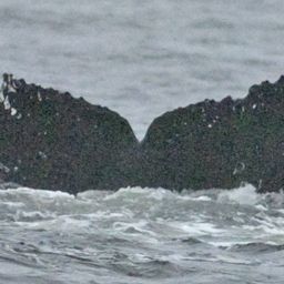
Vendetta – Residency 88th sighting in Lynn Canal & Stephens Passage Vendetta Confirmed in the catalog @18438 May 1 – Sep 15, 2026 · Lynn Canal & Stephens Passage Same Water, Every Summer Cold green shallows again — they keep finding me here. 118 m Deepest dive 4:35 Longest dive 738 Dives Sightings65 Days between first and last sighting137 Deepest dive on record 118 m · this residency ✳Dive stats modelled within real depth limits — not measured Get actual dive data with Risa Deep → SightingSeafloorSea tempDeepest dive ✳(modelled)May 1, 2026131 m6.1°C118 mMay 21, 202665 m7.8°C49 mMay 22, 2026108 m7.8°C57 mMay 23, 202694 m7.6°C31 mMay 24, 202682 m7.8°C44 mMay 25, 202657 m7.5°C52 mMay 26, 202662 m7.4°C53 mJul 7, 2026168 m12.1°C117 mJul 8, 2026103 m12.1°C37 mJul 9, 2026110 m12.3°C52 mJul 12, 2026113 m12.8°C36 mJul 13, 2026145 m13.0°C91 mJul 14, 2026103 m13.1°C76 mJul 15, 202671 m13.5°C59 mJul 16, 202695 m13.1°C65 mJul 17, 202699 m13.1°C72 mJul 18, 202692 m13.1°C32 mJul 19, 202691 m13.0°C46 m Seafloor and sea temperature measured · ✳ dives modelled · Show all 65 © OpenStreetMap contributors Deepest dive against the seafloor, per sighting Seafloor · measured Deepest dive · modelled May 1, 2026 — seafloor 131 m (measured), deepest dive 118 m (modelled)May 1May 21, 2026 — seafloor 65 m (measured), deepest dive 49 m (modelled)May 22, 2026 — seafloor 108 m (measured), deepest dive 57 m (modelled)May 23, 2026 — seafloor 94 m (measured), deepest dive 31 m (modelled)May 24, 2026 — seafloor 82 m (measured), deepest dive 44 m (modelled)May 25, 2026 — seafloor 57 m (measured), deepest dive 52 m (modelled)May 26, 2026 — seafloor 62 m (measured), deepest dive 53 m (modelled)Jul 7, 2026 — seafloor 168 m (measured), deepest dive 117 m (modelled)Jul 8, 2026 — seafloor 103 m (measured), deepest dive 37 m (modelled)Jul 9, 2026 — seafloor 110 m (measured), deepest dive 52 m (modelled)Jul 12, 2026 — seafloor 113 m (measured), deepest dive 36 m (modelled)Jul 13, 2026 — seafloor 145 m (measured), deepest dive 91 m (modelled)Jul 13Jul 14, 2026 — seafloor 103 m (measured), deepest dive 76 m (modelled)Jul 15, 2026 — seafloor 71 m (measured), deepest dive 59 m (modelled)Jul 16, 2026 — seafloor 95 m (measured), deepest dive 65 m (modelled)Jul 17, 2026 — seafloor 99 m (measured), deepest dive 72 m (modelled)Jul 18, 2026 — seafloor 92 m (measured), deepest dive 32 m (modelled)Jul 19, 2026 — seafloor 91 m (measured), deepest dive 46 m (modelled)Jul 21, 2026 — seafloor 141 m (measured), deepest dive 90 m (modelled)Jul 22, 2026 — seafloor 99 m (measured), deepest dive 59 m (modelled)Jul 23, 2026 — seafloor 72 m (measured), deepest dive 56 m (modelled)Jul 24, 2026 — seafloor 73 m (measured), deepest dive 42 m (modelled)Jul 25, 2026 — seafloor 181 m (measured), deepest dive 111 m (modelled)Jul 25Jul 26, 2026 — seafloor 110 m (measured), deepest dive 66 m (modelled)Jul 27, 2026 — seafloor 86 m (measured), deepest dive 61 m (modelled)Jul 28, 2026 — seafloor 122 m (measured), deepest dive 57 m (modelled)Jul 29, 2026 — seafloor 66 m (measured), deepest dive 48 m (modelled)Jul 30, 2026 — seafloor 64 m (measured), deepest dive 30 m (modelled)Jul 31, 2026 — seafloor 85 m (measured), deepest dive 64 m (modelled)Aug 1, 2026 — seafloor 91 m (measured), deepest dive 51 m (modelled)Aug 2, 2026 — seafloor 108 m (measured), deepest dive 84 m (modelled)Aug 3, 2026 — seafloor 113 m (measured), deepest dive 51 m (modelled)Aug 4, 2026 — seafloor 112 m (measured), deepest dive 64 m (modelled)Aug 5, 2026 — seafloor 101 m (measured), deepest dive 28 m (modelled)Aug 5Aug 6, 2026 — seafloor 60 m (measured), deepest dive 28 m (modelled)Aug 7, 2026 — seafloor 134 m (measured), deepest dive 35 m (modelled)Aug 8, 2026 — seafloor 123 m (measured), deepest dive 64 m (modelled)Aug 9, 2026 — seafloor 92 m (measured), deepest dive 68 m (modelled)Aug 10, 2026 — seafloor 111 m (measured), deepest dive 43 m (modelled)Aug 11, 2026 — seafloor 162 m (measured), deepest dive 71 m (modelled)Aug 12, 2026 — seafloor 100 m (measured), deepest dive 31 m (modelled)Aug 13, 2026 — seafloor 90 m (measured), deepest dive 38 m (modelled)Aug 15, 2026 — seafloor 115 m (measured), deepest dive 69 m (modelled)Aug 16, 2026 — seafloor 82 m (measured), deepest dive 72 m (modelled)Aug 18, 2026 — seafloor 89 m (measured), deepest dive 71 m (modelled)Aug 18Aug 19, 2026 — seafloor 103 m (measured), deepest dive 44 m (modelled)Aug 20, 2026 — seafloor 61 m (measured), deepest dive 55 m (modelled)Aug 22, 2026 — seafloor 99 m (measured), deepest dive 73 m (modelled)Aug 23, 2026 — seafloor 88 m (measured), deepest dive 55 m (modelled)Aug 26, 2026 — seafloor 72 m (measured), deepest dive 34 m (modelled)Aug 27, 2026 — seafloor 46 m (measured), deepest dive 34 m (modelled)Aug 28, 2026 — seafloor 89 m (measured), deepest dive 59 m (modelled)Aug 29, 2026 — seafloor 102 m (measured), deepest dive 41 m (modelled)Aug 30, 2026 — seafloor 116 m (measured), deepest dive 81 m (modelled)Aug 31, 2026 — seafloor 41 m (measured), deepest dive 34 m (modelled)Sep 1, 2026 — seafloor 119 m (measured), deepest dive 57 m (modelled)Sep 1Sep 4, 2026 — seafloor 106 m (measured), deepest dive 79 m (modelled)Sep 6, 2026 — seafloor 95 m (measured), deepest dive 66 m (modelled)Sep 9, 2026 — seafloor 110 m (measured), deepest dive 86 m (modelled)Sep 10, 2026 — seafloor 72 m (measured), deepest dive 65 m (modelled)Sep 11, 2026 — seafloor 61 m (measured), deepest dive 34 m (modelled)Sep 12, 2026 — seafloor 94 m (measured), deepest dive 62 m (modelled)Sep 13, 2026 — seafloor 181 m (measured), deepest dive 40 m (modelled)Sep 14, 2026 — seafloor 133 m (measured), deepest dive 80 m (modelled)Sep 15, 2026 — seafloor 72 m (measured), deepest dive 66 m (modelled) Depth runs down from the surface. The modelled dive never passes the measured seafloor at that sighting. Dives Personal record — deepest dive 118 m · the deepest in this whale’s modelled history 118 m Deepest dive 4:35 Longest dive 738 Dives 24 m Avg dive depth 65 Sightings 137 Days first → last ✳Dive metrics are modelled within real depth limits — not measured Get actual dive data with Risa Deep → Dive profile ✳ modelled 075150118 mstartdive sequence (illustrative) Depth shaped by the seafloor limit here (131 m) and the published dive-behaviour distribution. Modelled, not measured. Deep Effort Score Deep Depth, duration and recovery resolved into a single number for this session. Unlock with Risa Deep Place Where this happened · May 1, 2026 ✓ measured Seafloor depth131 m Sea-surface temperature6.1°C Distance from shore1.0 km Across the residency · 65 sightings ✓ measured Seafloor depth41 m – 181 m Sea-surface temperature6.1°C – 15.6°C Distance from shore1.0 km – 4.0 km 17 Bubbles Sources: GEBCO seafloor grid · NASA JPL MUR sea temperature · PacIOOS coastline distance © OpenStreetMap contributors Source records This activity is assembled from 65 catalogued encounters on Happywhale. May 1, 2026May 21, 2026May 22, 2026May 23, 2026May 24, 2026May 25, 2026May 26, 2026Jul 7, 2026Jul 8, 2026Jul 9, 2026Jul 12, 2026Jul 13, 2026 Show all 65 records ›