Flame – Residency
7th sighting in Gulf of Maine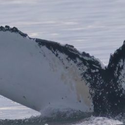
Flame @84127
Aug 8 – Sep 15, 2026 · Gulf of Maine
August on the Shelf
Thick water, good crowd, this ground never lets me down.
32 m
Deepest dive
1:57
Longest dive
18
Dives
- Sightings
- 3
- Days between first and last sighting
- 38
Dive stats modelled within real depth limits — not measured
Get actual dive data with Risa Deep →| Sighting | Seafloor | Sea temp | Deepest dive (modelled) |
|---|---|---|---|
| Aug 8, 2026 | 120 m | 16.4°C | 29 m |
| Aug 19, 2026 | 51 m | 15.5°C | 32 m |
| Sep 15, 2026 | 51 m | — | 25 m |
Seafloor and sea temperature measured · ✳ dives modelled

Deepest dive against the seafloor, per sighting
Seafloor · measured Deepest dive · modelledDepth runs down from the surface. The modelled dive never passes the measured seafloor at that sighting.
Dives
32 m
Deepest dive
1:57
Longest dive
18
Dives
17 m
Avg dive depth
3
Sightings
38
Days first → last
Dive metrics are modelled within real depth limits — not measured
Get actual dive data with Risa Deep →Dive profile
modelledDepth shaped by the seafloor limit here (51 m) and the published dive-behaviour distribution. Modelled, not measured.
Deep Effort Score
DeepPlace
Where this happened · Aug 19, 2026
measured- Seafloor depth
- 51 m
- Sea-surface temperature
- 15.5°C
- Distance from shore
- 4.0 km
Across the residency · 3 sightings
measured- Seafloor depth
- 51 m – 120 m
- Sea-surface temperature
- 15.5°C – 16.4°C
- Distance from shore
- 4.0 km – 28.0 km
Sources: GEBCO seafloor grid · NASA JPL MUR sea temperature · PacIOOS coastline distance
Source records
This activity is assembled from 3 catalogued encounters on Happywhale.