CRC-30102 – Residency
5th sighting in Gulf of California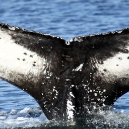
CRC-30102 @91737
Feb 17 – Mar 3, 2026 · Gulf of California
Gulf of California · Feb – Mar 2026
69 m
Deepest dive
2:50
Longest dive
58
Dives
- Sightings
- 4
- Days between first and last sighting
- 14
Dive stats modelled within real depth limits — not measured
Get actual dive data with Risa Deep →| Sighting | Seafloor | Sea temp | Deepest dive (modelled) |
|---|---|---|---|
| Feb 17, 2026 | 1,022 m | 23.1°C | 67 m |
| Feb 17, 2026 | 139 m | 23.1°C | 69 m |
| Mar 3, 2026 | 17 m | 22.8°C | 15 m |
| Mar 3, 2026 | 1,022 m | 22.8°C | 61 m |
Seafloor and sea temperature measured · ✳ dives modelled

Deepest dive against the seafloor, per sighting
Seafloor · measured Deepest dive · modelledDepth runs down from the surface. The modelled dive never passes the measured seafloor at that sighting.
Dives
69 m
Deepest dive
2:50
Longest dive
58
Dives
21 m
Avg dive depth
4
Sightings
14
Days first → last
Dive metrics are modelled within real depth limits — not measured
Get actual dive data with Risa Deep →Dive profile
modelledDepth shaped by the seafloor limit here (139 m) and the published dive-behaviour distribution. Modelled, not measured.
Deep Effort Score
DeepPlace
Where this happened · Feb 17, 2026
measured- Seafloor depth
- 139 m
- Sea-surface temperature
- 23.1°C
- Distance from shore
- 3.0 km
Across the residency · 4 sightings
measured- Seafloor depth
- 17 m – 1,022 m
- Sea-surface temperature
- 22.8°C – 23.1°C
- Distance from shore
- 3.0 km – 5.0 km
Sources: GEBCO seafloor grid · NOAA OISST sea temperature · PacIOOS coastline distance
Source records
This activity is assembled from 4 catalogued encounters on Happywhale.